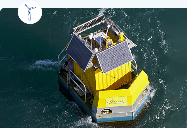
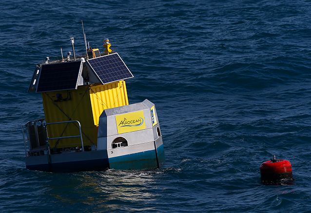
WINDSEA is a new generation of floating LiDAR turnkey service for wind resource assessment and metocean measurements.
WINDSEA is Stage 3 validated according to Carbon Trust roadmap by DNV.
Our floating LiDARs have been deployed in many seas and has accumulated more than 12 000 days of data reaching best industry practices.
Stage 3 carbon trust validated with Windcube offshore V2 offshore wind lidar
Sharable with a large range of other sensors
Passive stabilization system
365/7 monitored (via onshore center)
Robust and sea proven
Eco-friendly (no diesel on board )
High O&M and QHSE expertise
Plenty of power available
Safe work on-board
PLATFORM
DIMENSIONS & WEIGHT
Float Length: 5,1m / Height: 2,4 m / Width: 3m Draught: 1,2m, Air draft: approx. 3,5 m
STABILIZATION
Passive system (Anti pitching water tank + Anti rolling keel) – up to 60% pitch reduction
POWER AVAILABLE
Up to 2 kW (wave, solar and fuel cell)
MARITIME SAFETY
Compliant to IALA recommendations : AIS, GPS, Lantern, Daymark, radar reflector, ID plate equipped
WIND MEASUREMENT
LIDAR TYPE
LEOSPHERE offshore WINDCUBE V2.1
HEIGHT RANGE
From 40 to 300 m, up to 20 targets
SPEED RANGE
From 0 to 60+ m/s
DATA MANAGEMENT
DATA FREQUENCY
1 second (raw data) to 10 min (averaging data)
STORAGE
Back-up on board + dedicated server onshore
DATA TRANSFER
GPRS/Satellite
DATA VERIFICATION
Daily data post-processing and checking routines
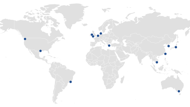
AKROCEAN can offer modular buoys deployments anywhere in the world. We rely on our network of commercial and/or logistic partners around the world, specialists in their field, to support AKROCEAN in each of these locations.
IN 2022
12
Country
3
Continents
3
Solutions

FLY’RSEA, our floating RADAR solution for bird detection, is the first technology able to assess birds, bats, mammals and fishes presence on the same system.

SEAOBS, combining measurements of WINDSEA, FLY’RSEA, and beyond… Seaobs is a multiparameters offshore observatory for environmental site studies.
About the company
Adress